Aprašymas
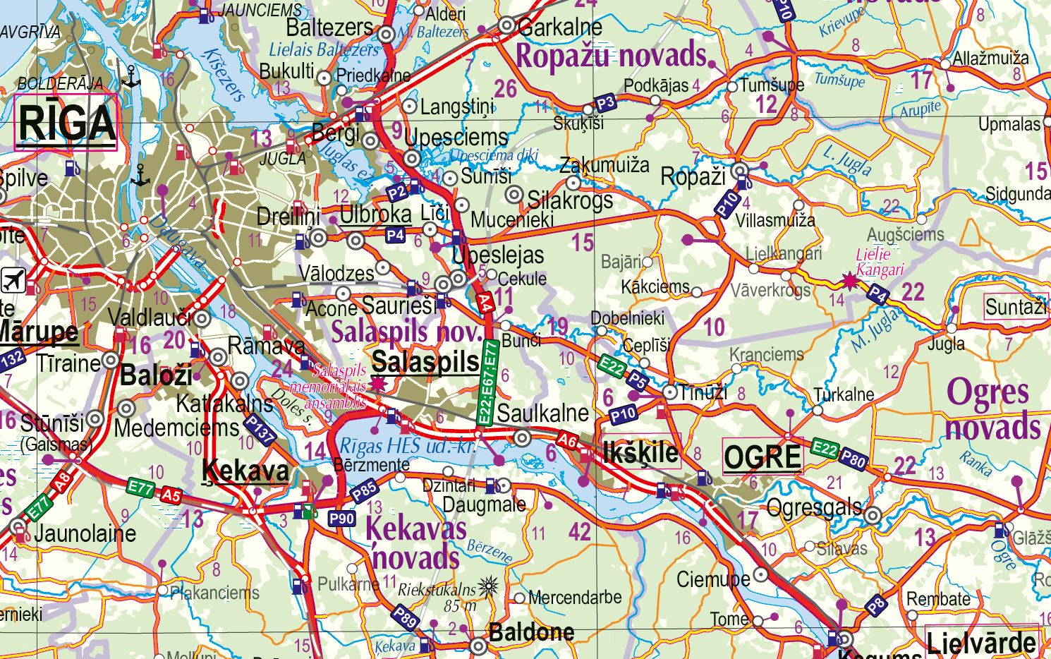
The Latvian Road Map at a scale of 1:500,000 is the most popular among Jāņa Sēta’s road maps, and its practical use is still largely focused on navigation tasks – this map is most commonly found in cars. Even if we use various types of digital navigation solutions for everyday navigation purposes, a paper map is very useful for overall route planning as well as for monitoring the chosen route. Another important aspect to consider in today’s world is that a paper map can become absolutely indispensable in situations where mobile internet or GPS signal is unavailable. That is why maps are also included in the Ministry of Defence’s recommendations for the contents of a 72-hour emergency bag. This particular map of Latvia is most suitable for that purpose – detailed enough, yet not overly large.
The updated 2024 edition of the Latvian road map includes the latest changes in the road network (for example, the Ķekava bypass). The map displays all major roads, their surfaces, and distances between key intersections. It includes the current administrative division and populated places, other transport infrastructure (including the under-construction Rail Baltica railway network), as well as many other layers of information that meet the standards of maps at this scale and scope.
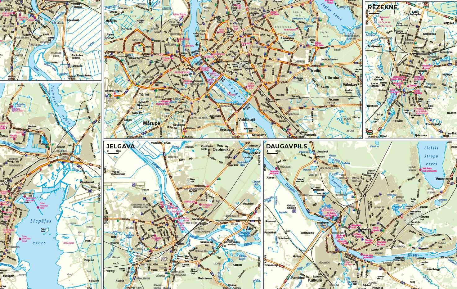
The Latvian road map is supplemented with an alphabetical index of populated places and a distance table, as well as city plans of Rīga, Daugavpils, Jelgava, Liepāja, Rēzekne, Valmiera, and Ventspils, with a scale suitable for locating key sites or navigating through the city. For more detailed city exploration and address searches, we recommend using maps at a larger scale.
The Latvian road map is also available in a wall map format: Road map of Latvia.