Description
Hard covers, name index book with largest city plans. Map is prepared and published in collaboration with Freytag&Berndt cartographers.
Home / Maps and atlases / Road maps and atlases of Europe / Lielbritānija. Īrija. Autoceļu karte
€ 6.30 Original price was: € 6.30.€ 2.00Current price is: € 2.00. include TAX
Edition of the year 2018
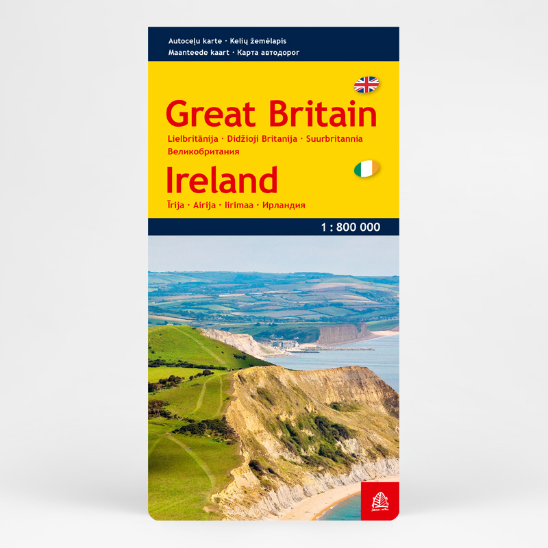
Scale 1: 800 000
Size 124 x 84 cm / 13 x 25.5 cm folded
Hard covers
EAN: 9789984074917
Hard covers, name index book with largest city plans. Map is prepared and published in collaboration with Freytag&Berndt cartographers.
| Cookie | Duration | Description |
|---|---|---|
| cookielawinfo-checkbox-advertisement | 1 year | Set by the GDPR Cookie Consent plugin, this cookie records the user consent for the cookies in the "Advertisement" category. |
| cookielawinfo-checkbox-analytics | 11 months | This cookie is set by GDPR Cookie Consent plugin. The cookie is used to store the user consent for the cookies in the category "Analytics". |
| cookielawinfo-checkbox-functional | 11 months | The cookie is set by GDPR cookie consent to record the user consent for the cookies in the category "Functional". |
| cookielawinfo-checkbox-necessary | 11 months | This cookie is set by GDPR Cookie Consent plugin. The cookies is used to store the user consent for the cookies in the category "Necessary". |
| cookielawinfo-checkbox-others | 11 months | This cookie is set by GDPR Cookie Consent plugin. The cookie is used to store the user consent for the cookies in the category "Other. |
| cookielawinfo-checkbox-performance | 11 months | This cookie is set by GDPR Cookie Consent plugin. The cookie is used to store the user consent for the cookies in the category "Performance". |
| CookieLawInfoConsent | 1 year | CookieYes sets this cookie to record the default button state of the corresponding category and the status of CCPA. It works only in coordination with the primary cookie. |
| ellipsis.sessionid | 1 hour | Ellipsis sets this cookie to protect the website from spam and establishes a session cookie so that when you submit a contact form or post a comment, your form submission will be passed along with an anonymized IP address through Human Presence. |
| ellipsis.sessionts | 1 hour | Ellipsis sets this cookie to protect the website from spam and establishes a session cookie so that when you submit a contact form or post a comment, your form submission will be passed along with an anonymized IP address through Human Presence. |
| qtrans_front_language | 1 year | This cookie is set by qTranslate WordPress plugin. The cookie is used to manage the preferred language of the visitor. |
| viewed_cookie_policy | 11 months | The cookie is set by the GDPR Cookie Consent plugin and is used to store whether or not user has consented to the use of cookies. It does not store any personal data. |
| woocommerce_cart_hash | session | WooCommerce sets this cookie to determine when cart contents/data changes. |
| Cookie | Duration | Description |
|---|---|---|
| _fbp | 3 months | Facebook sets this cookie to display advertisements when either on Facebook or on a digital platform powered by Facebook advertising after visiting the website. |
| Cookie | Duration | Description |
|---|---|---|
| woocommerce_recently_viewed | session | WooCommerce sets this cookie to store performed actions on the website. |